
File:California map showing Solano County.png
Ala nang mas malino pa.
California_map_showing_Solano_County.png (200 × 231 pixel, sukad ning simpan: 22 KB, MIME type: image/png)
Sampulung (summary)
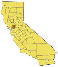
- Locator map of Solano County — in California.

|
Permission is granted to copy, distribute and/or modify this document under the terms of the GNU Free Documentation License, Version 1.2 or any later version published by the Free Software Foundation; with no Invariant Sections, no Front-Cover Texts, and no Back-Cover Texts. A copy of the license is included in the section entitled GNU Free Documentation License. |
| This file is licensed under the Creative Commons Attribution-Share Alike 3.0 Unported license. | ||
| ||
| This licensing tag was added to this file as part of the GFDL licensing update. |
Amlat ning simpan (File history)
Mag-click kang petsa/oras ba meng akit ing itsura ning simpan aniang panaun a ita.
| Petsa/Oras | Thumbnail | Sukad | Talagamit | Komentu/Puna | |
|---|---|---|---|---|---|
| salukuyan | 15:28, 14 Juliu 2005 | | 200 × 231 (22 KB) | Pyramide~commonswiki | Map of Solano county in California. From en: {{GFDL}} Category:Maps of counties in California |
↓Suglung kareng simpan (''file links'')
Ing tutuking page links kaniting simpan (file):
Global file usage
The following other wikis use this file:
- Usage on bg.wikipedia.org
- Usage on en.wikipedia.org
- Cordelia, California
- Template:SolanoCountyCA-geo-stub
- Horse Creek (California)
- Hastings Mine
- St. John's Mine
- City Park, Benicia
- Rindler Creek
- Grizzly Bay
- Mare Island Strait
- Roe Island
- Ryer Island
- Ryer Island Ferry
- Rockville, California
- English Hills
- Potrero Hills (Solano County, California)
- Ryer Island (Suisun Bay)
- Batavia, California
- Howard Landing Ferry
- Morrow Island
- Tremont Township, Solano County, California
- Denverton, California
- Hammond Island (California)
- Dutton Island
- Freeman Island (California)
- Grizzly Island
- Simmons Island
- Snag Island
- Wheeler Island (California)
- Decker Island
- Prospect Island (California)
- Lynch Canyon Open Space Park
- French Island (California)
- Liberty Island (California)
- Hastings Tract
- Bradmoor Island
- Deadman Island (Solano County)
- Goat Island (Solano County)
- Middle Ground Island
- Spinner Island
- Little Island (California)
- Island No. 1
- Knight Island (California)
View more global usage of this file.