
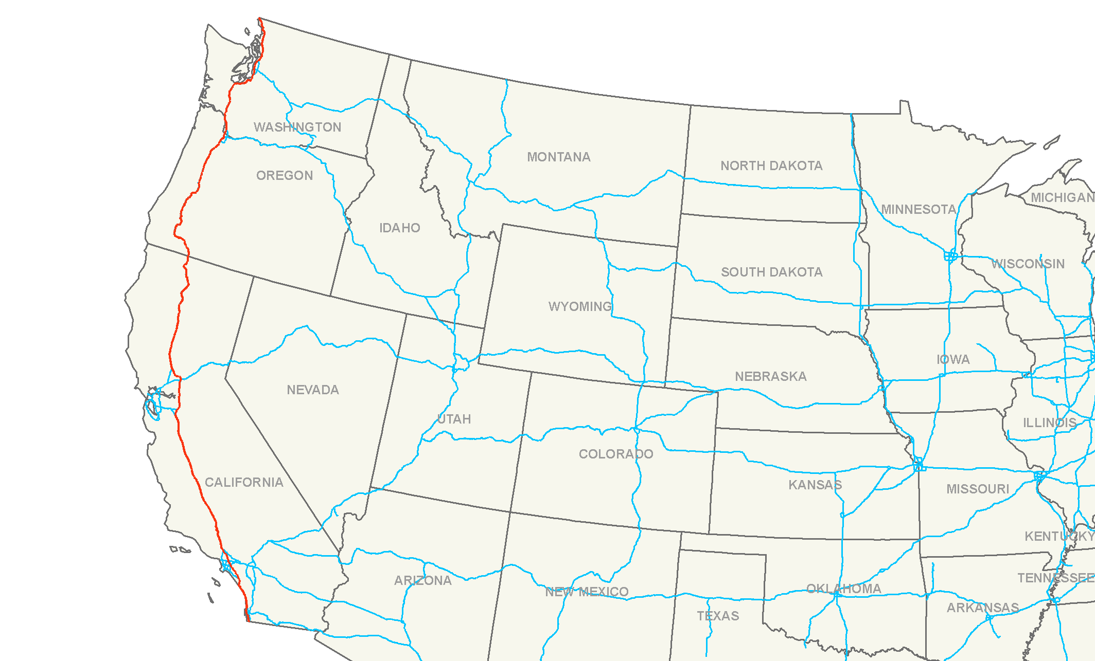
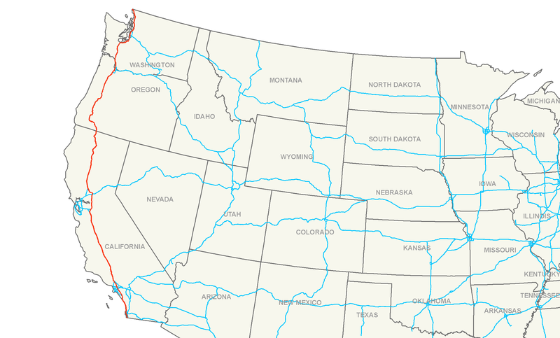
File:Interstate 5 map.png
Size of this preview: 800 × 483 pixels. Other resolutions: 320 × 193 pixels | 640 × 387 pixels | 1,024 × 619 pixels | 1,280 × 774 pixels | 2,128 × 1,286 pixels.
Ing minunang simpan (file) (2,128 × 1,286 pixel, sukad ning simpan: 84 KB, MIME type: image/png)
| Description | Map of Interstate 5 |
| Petsa | |
| Pikuanan | Own work |
| Maki-akda | Nick Nolte |
| Permission (Reusing this file) |
Own work, all rights released (Public domain) |
I, the copyright holder of this work, hereby publish it under the following license:
| This file is made available under the Creative Commons CC0 1.0 Universal Public Domain Dedication. | |
| The person who associated a work with this deed has dedicated the work to the public domain by waiving all of their rights to the work worldwide under copyright law, including all related and neighboring rights, to the extent allowed by law. You can copy, modify, distribute and perform the work, even for commercial purposes, all without asking permission.
|
Amlat ning simpan (File history)
Mag-click kang petsa/oras ba meng akit ing itsura ning simpan aniang panaun a ita.
| Petsa/Oras | Thumbnail | Sukad | Talagamit | Komentu/Puna | |
|---|---|---|---|---|---|
| salukuyan | 05:14, 16 Juliu 2006 | | 2,128 × 1,286 (84 KB) | Stratosphere | {{Information| |Description=Map of Interstate 5 |Source=Own Work |Date=July 15, 2006 |Author=Nick Nolte |Permission=Own work, all rights released (Public domain) |other_versions= }} {{PD-self}} Category:U.S. Interstate Maps[[ |
↓Suglung kareng simpan (''file links'')
Ing tutuking page links kaniting simpan (file):
Global file usage
The following other wikis use this file:
- Usage on da.wikipedia.org
- Usage on de.wikipedia.org
- Usage on eo.wikipedia.org
- Usage on es.wikipedia.org
- Usage on et.wikipedia.org
- Usage on eu.wikipedia.org
- Usage on fa.wikipedia.org
- Usage on fi.wikipedia.org
- Usage on he.wikipedia.org
- Usage on hu.wikipedia.org
- Usage on it.wikipedia.org
- Usage on ja.wikipedia.org
- Usage on ko.wikipedia.org
- Usage on lmo.wikipedia.org
- Usage on nl.wikipedia.org
- Usage on no.wikipedia.org
- Usage on pl.wikipedia.org
- Usage on pt.wikipedia.org
- Usage on ru.wikipedia.org
- Usage on sv.wikipedia.org
- Usage on tr.wikipedia.org
- Usage on uk.wikipedia.org
- Usage on vi.wikipedia.org
- Usage on www.wikidata.org