
File:Intracoastal Waterway Louisiana.jpg

Size of this preview: 800 × 533 pixels. Other resolutions: 320 × 213 pixels | 640 × 427 pixels | 1,024 × 683 pixels | 1,500 × 1,000 pixels.
Ing minunang simpan (file) (1,500 × 1,000 pixel, sukad ning simpan: 508 KB, MIME type: image/jpeg)
| Description |
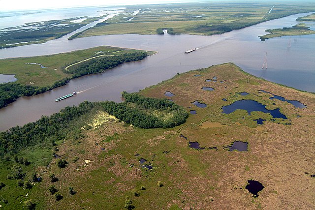
English: Navigation on the Gulf Intracoastal Waterway (GIWW), where it intersects with Bayou Perot in Louisiana, USA. The view in this picture is to the south. The GIWW runs left–right across the picture. The bayou comes in from the left and enters Lake Salvador on the right. The bayou is the boundary between Jefferson Parish in the foreground and Lafourche Parish in the distance beyond the bayou. |
|||
| Petsa | ||||
| Pikuanan |
U.S. Army Corps of Engineers Digital Visual Library Image page Image description page Digital Visual Library home page |
|||
| Maki-akda | Lane Lefort, U.S. Army Corps of Engineers | |||
| Permission (Reusing this file) |
|
|||
| Location | New Orleans, Louisiana, USA |
| Camera location | | View this and other nearby images on: OpenStreetMap |
|---|
Amlat ning simpan (File history)
Mag-click kang petsa/oras ba meng akit ing itsura ning simpan aniang panaun a ita.
| Petsa/Oras | Thumbnail | Sukad | Talagamit | Komentu/Puna | |
|---|---|---|---|---|---|
| salukuyan | 22:14, 1 Abril 2007 | | 1,500 × 1,000 (508 KB) | DanMS | {{Information | Description = {{en|Navigation on the Gulf Intracoastal Waterway (GIWW), where it intersects with Bayou Perot, in the vicinity of New Orleans, USA.}} | Source = U.S. Army Corps of Engineers Digital Visual Library<br />[http://ima |
↓Suglung kareng simpan (''file links'')
Ing tutuking page links kaniting simpan (file):
Global file usage
The following other wikis use this file:
- Usage on af.wikipedia.org
- Usage on arz.wikipedia.org
- Usage on bn.wikipedia.org
- Usage on cs.wikipedia.org
- Usage on de.wikipedia.org
- Usage on en.wikipedia.org
- Usage on es.wikipedia.org
- Usage on fi.wikipedia.org
- Usage on fr.wikipedia.org
- Usage on gu.wikipedia.org
- Usage on he.wikipedia.org
- Usage on it.wikipedia.org
- Usage on ja.wikipedia.org
- Usage on kn.wikipedia.org
- Usage on ro.wikipedia.org
- Usage on ru.wikipedia.org
- Usage on ur.wikipedia.org
- Usage on vi.wikipedia.org
- Usage on zh.wikipedia.org