
File:Japan Tohoku Region large.png
Size of this preview: 526 × 600 pixels. Other resolutions: 210 × 240 pixels | 421 × 480 pixels | 673 × 768 pixels | 898 × 1,024 pixels | 1,397 × 1,593 pixels.
Ing minunang simpan (file) (1,397 × 1,593 pixel, sukad ning simpan: 80 KB, MIME type: image/png)
Sampulung (summary)
| Description |
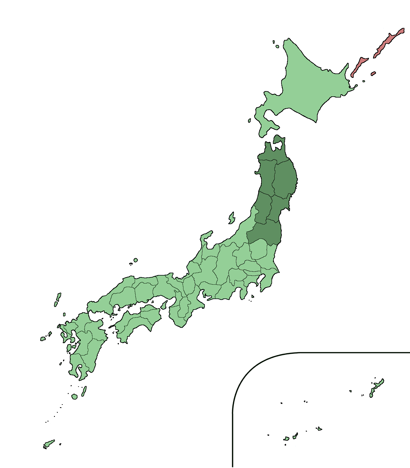
English: Large size map of Japan with Tohoku region highlighted,
|
| Petsa | |
| Pikuanan | Own work |
| Maki-akda | Ningyou |
| Other versions |
 |
Pamamie lisensia
| I, the copyright holder of this work, release this work into the public domain. This applies worldwide. In some countries this may not be legally possible; if so: I grant anyone the right to use this work for any purpose, without any conditions, unless such conditions are required by law. |
Amlat ning simpan (File history)
Mag-click kang petsa/oras ba meng akit ing itsura ning simpan aniang panaun a ita.
| Petsa/Oras | Thumbnail | Sukad | Talagamit | Komentu/Puna | |
|---|---|---|---|---|---|
| salukuyan | 15:25, 16 Oktubri 2005 | | 1,397 × 1,593 (80 KB) | Ningyou | Large size map of Japan with Tohoku region highlighted, self made but originally based on a japanese mapbook. Category:Maps of Japan |
↓Suglung kareng simpan (''file links'')
Ing tutuking page links kaniting simpan (file):
Global file usage
The following other wikis use this file:
- Usage on ar.wikipedia.org
- Usage on azb.wikipedia.org
- Usage on az.wikipedia.org
- Usage on bg.wikipedia.org
- Usage on bn.wikipedia.org
- Usage on ca.wikipedia.org
- Usage on ckb.wikipedia.org
- Usage on cy.wikipedia.org
- Usage on de.wikipedia.org
- Usage on el.wikinews.org
- Usage on en.wikipedia.org
- Usage on en.wiktionary.org
- Usage on eo.wikipedia.org
- Usage on eu.wikipedia.org
- Usage on fa.wikipedia.org
- Usage on fi.wikipedia.org
- Usage on fr.wikipedia.org
- Usage on fr.wiktionary.org
- Usage on ga.wikipedia.org
- Usage on gl.wikipedia.org
- Usage on hak.wikipedia.org
- Usage on he.wikipedia.org
- Usage on hi.wikipedia.org
- Usage on hr.wikipedia.org
- Usage on hu.wikipedia.org
- Usage on hy.wikipedia.org
- Usage on ilo.wikipedia.org
- Usage on ja.wikipedia.org
- Usage on ja.wiktionary.org
- Usage on ko.wikipedia.org
- Usage on la.wikipedia.org
- Usage on lv.wikipedia.org
- Usage on mk.wikipedia.org
- Usage on mr.wikipedia.org
- Usage on my.wikipedia.org
- Usage on nn.wikipedia.org
- Usage on no.wikipedia.org
- Usage on oc.wikipedia.org
- Usage on pl.wikipedia.org
- Usage on pnb.wikipedia.org
- Usage on ps.wikipedia.org
- Usage on pt.wikipedia.org
- Usage on pt.wiktionary.org
- Usage on ro.wikipedia.org
- Usage on ru.wikivoyage.org
View more global usage of this file.