
File:Main towns in the province of Valencia.png
Ala nang mas malino pa.
Main_towns_in_the_province_of_Valencia.png (524 × 535 pixel, sukad ning simpan: 108 KB, MIME type: image/png)
Sampulung (summary)
| Description |
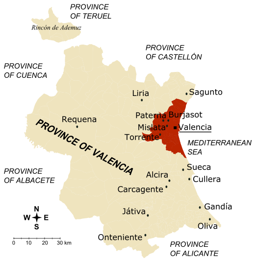
Map of the province of Valencia (Spain)
|
| Petsa | 10 Disyembri 2006 (original upload date) |
| Pikuanan | No machine-readable source provided. Own work assumed (based on copyright claims). |
| Maki-akda | No machine-readable author provided. Rodriguillo assumed (based on copyright claims). |
.png)
Pamamie lisensia
Rodriguillo, the copyright holder of this work, hereby publishes it under the following license:
| I, the copyright holder of this work, release this work into the public domain. This applies worldwide. In some countries this may not be legally possible; if so: I grant anyone the right to use this work for any purpose, without any conditions, unless such conditions are required by law. |
Amlat ning simpan (File history)
Mag-click kang petsa/oras ba meng akit ing itsura ning simpan aniang panaun a ita.
| Petsa/Oras | Thumbnail | Sukad | Talagamit | Komentu/Puna | |
|---|---|---|---|---|---|
| salukuyan | 14:31, 10 Disyembri 2006 | | 524 × 535 (108 KB) | Rodriguillo | '''Map of the province of Valencia''' (Spain) * The inner city and the towns conforming the first crown of Valencia metropolitan area are drawn in dark brown; together, they concentrate 60.62% of the province population in 5.73% of its surface, wi |
↓Suglung kareng simpan (''file links'')
Ing tutuking page links kaniting simpan (file):
Global file usage
The following other wikis use this file:
- Usage on da.wikipedia.org
- Usage on en.wikipedia.org
- Usage on fa.wikipedia.org
- Usage on fi.wikipedia.org
- Usage on no.wikipedia.org
- Usage on sco.wikipedia.org
- Usage on vi.wikipedia.org