
File:Map of California highlighting Tuolumne County.svg

Size of this PNG preview of this SVG file: 523 × 599 pixels. Other resolutions: 209 × 240 pixels | 419 × 480 pixels | 670 × 768 pixels | 894 × 1,024 pixels | 1,787 × 2,048 pixels | 1,022 × 1,171 pixels.
Ing minunang simpan (file) (SVG file, masasabing 1,022 × 1,171 pixels, dagul ning simpan: 508 KB)
Sampulung (summary)
| Description |
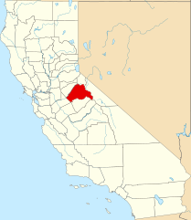
English: This is a locator map showing Tuolumne County in California. For more information, see Commons:United States county locator maps. |
| Petsa | |
| Pikuanan |
Own work: English: The maps use data from nationalatlas.gov, specifically countyp020.tar.gz on the Raw Data Download page. The maps also use state outline data from statesp020.tar.gz. The Florida maps use hydrogm020.tar.gz to display Lake Okeechobee. |
| Maki-akda | David Benbennick |
Pamamie lisensia
| I, the copyright holder of this work, release this work into the public domain. This applies worldwide. In some countries this may not be legally possible; if so: I grant anyone the right to use this work for any purpose, without any conditions, unless such conditions are required by law. |
Amlat ning simpan (File history)
Mag-click kang petsa/oras ba meng akit ing itsura ning simpan aniang panaun a ita.
| Petsa/Oras | Thumbnail | Sukad | Talagamit | Komentu/Puna | |
|---|---|---|---|---|---|
| salukuyan | 16:03, 26 Nobyembri 2016 | | 1,022 × 1,171 (508 KB) | Spartan7W | Update HQ map |
| 10:28, 12 Pebreru 2006 |  | 9,164 × 10,536 (229 KB) | David Benbennick | {{subst:User:Dbenbenn/clm|county=Tuolumne County|state=California}} |
↓Suglung kareng simpan (''file links'')
Ing tutuking page links kaniting simpan (file):
Global file usage
The following other wikis use this file:
- Usage on ar.wikipedia.org
- Usage on az.wikipedia.org
- Usage on ban.wikipedia.org
- Usage on bg.wikipedia.org
- Usage on bpy.wikipedia.org
- Usage on ca.wikipedia.org
- Usage on ceb.wikipedia.org
- Usage on ce.wikipedia.org
- Usage on cs.wikipedia.org
- Usage on cy.wikipedia.org
- Usage on da.wikipedia.org
- Usage on de.wikipedia.org
- Usage on en.wikipedia.org
- List of counties in California
- Tuolumne County, California
- Chinese Camp, California
- Columbia, California
- East Sonora, California
- Groveland-Big Oak Flat, California
- Jamestown, California
- Mi-Wuk Village, California
- Mono Vista, California
- Phoenix Lake-Cedar Ridge, California
- Sonora, California
- Soulsbyville, California
- Tuolumne City, California
- Twain Harte, California
- Template:Tuolumne County, California
View more global usage of this file.