
File:Pinatubo evacuation areas.gif

Size of this preview: 800 × 575 pixels. Other resolutions: 320 × 230 pixels | 640 × 460 pixels | 1,000 × 719 pixels.
Ing minunang simpan (file) (1,000 × 719 pixel, sukad ning simpan: 95 KB, MIME type: image/gif)
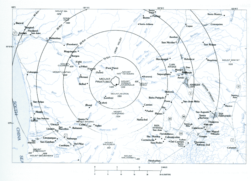
Volcanic hazard areas surrounding Mount Pinatubo.
This image is in the public domain in the United States because it only contains materials that originally came from the United States Geological Survey, an agency of the United States Department of the Interior. For more information, see the official USGS copyright policy.
|
Amlat ning simpan (File history)
Mag-click kang petsa/oras ba meng akit ing itsura ning simpan aniang panaun a ita.
| Petsa/Oras | Thumbnail | Sukad | Talagamit | Komentu/Puna | |
|---|---|---|---|---|---|
| salukuyan | 09:59, 8 Marsu 2006 | | 1,000 × 719 (95 KB) | Magalhães | Volcanic hazard areas surrounding Mount Pinatubo. {{PD-USGov-Interior-USGS}} Category:Mount Pinatubo |
↓Suglung kareng simpan (''file links'')
Ing tutuking page links kaniting simpan (file):
Global file usage
The following other wikis use this file:
- Usage on bg.wikipedia.org
- Usage on cs.wikipedia.org
- Usage on el.wikipedia.org
- Usage on en.wikipedia.org
- Usage on es.wikipedia.org
- Usage on fr.wikipedia.org
- Usage on he.wikipedia.org
- Usage on nl.wikipedia.org