
File:Provinces of Tuscany map.png
Size of this preview: 783 × 599 pixels. Other resolutions: 314 × 240 pixels | 627 × 480 pixels | 989 × 757 pixels.
Ing minunang simpan (file) (989 × 757 pixel, sukad ning simpan: 188 KB, MIME type: image/png)

|
File:Map of region of Tuscany, Italy, with provinces-it.svg is a vector version of this file. It should be used in place of this PNG file when not inferior.
File:Provinces of Tuscany map.png → File:Map of region of Tuscany, Italy, with provinces-it.svg
For more information, see Help:SVG. |
 |
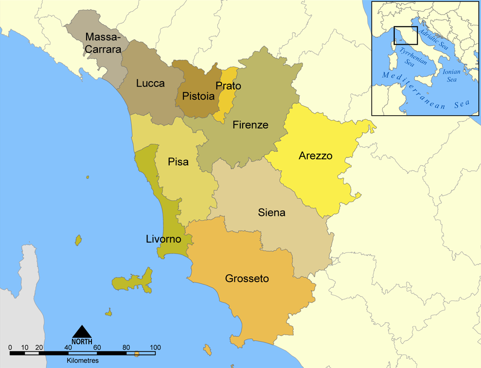
This map shows the provinces of the Italian region of Tuscany.
Created by NormanEinstein, August 26, 2005.
I, the copyright holder of this work, hereby publish it under the following license:

|
Permission is granted to copy, distribute and/or modify this document under the terms of the GNU Free Documentation License, Version 1.2 or any later version published by the Free Software Foundation; with no Invariant Sections, no Front-Cover Texts, and no Back-Cover Texts. A copy of the license is included in the section entitled GNU Free Documentation License. |
| This file is licensed under the Creative Commons Attribution-Share Alike 3.0 Unported license. | ||
| ||
| This licensing tag was added to this file as part of the GFDL licensing update. |
Amlat ning simpan (File history)
Mag-click kang petsa/oras ba meng akit ing itsura ning simpan aniang panaun a ita.
| Petsa/Oras | Thumbnail | Sukad | Talagamit | Komentu/Puna | |
|---|---|---|---|---|---|
| salukuyan | 14:08, 12 Eneru 2011 | | 989 × 757 (188 KB) | Ras67 | cropped |
| 19:34, 8 Abril 2006 |  | 1,000 × 769 (211 KB) | Pitichinaccio | corrected spelling of Pistoia (was Pistoria) | |
| 20:57, 26 Agostu 2005 |  | 1,000 × 769 (276 KB) | NormanEinstein | This map shows the provinces of the Italian region of Tuscany. Created by NormanEinstein, August 26, 2005. {{GFDL-self}} Category: Maps of Italy |
↓Suglung kareng simpan (''file links'')
Ing tutuking page links kaniting simpan (file):
Global file usage
The following other wikis use this file:
- Usage on an.wikipedia.org
- Usage on ar.wikipedia.org
- Usage on arz.wikipedia.org
- Usage on ast.wikipedia.org
- Usage on br.wikipedia.org
- Usage on ca.wikipedia.org
- Usage on ceb.wikipedia.org
- Usage on cs.wikipedia.org
- Usage on de.wikipedia.org
- Usage on de.wikivoyage.org
- Usage on en.wikipedia.org
- Usage on en.wiktionary.org
- Usage on es.wikipedia.org
- Usage on es.wikiversity.org
View more global usage of this file.