
File:Regions and Prefectures of Japan.png
Size of this preview: 441 × 600 pixels. Other resolutions: 176 × 240 pixels | 353 × 480 pixels | 565 × 768 pixels | 753 × 1,024 pixels | 2,480 × 3,372 pixels.
Ing minunang simpan (file) (2,480 × 3,372 pixel, sukad ning simpan: 667 KB, MIME type: image/png)

|
File:Regions and Prefectures of Japan.svg is a vector version of this file. It should be used in place of this PNG file when not inferior.
File:Regions and Prefectures of Japan.png → File:Regions and Prefectures of Japan.svg
For more information, see Help:SVG. |
 |
Sampulung (summary)
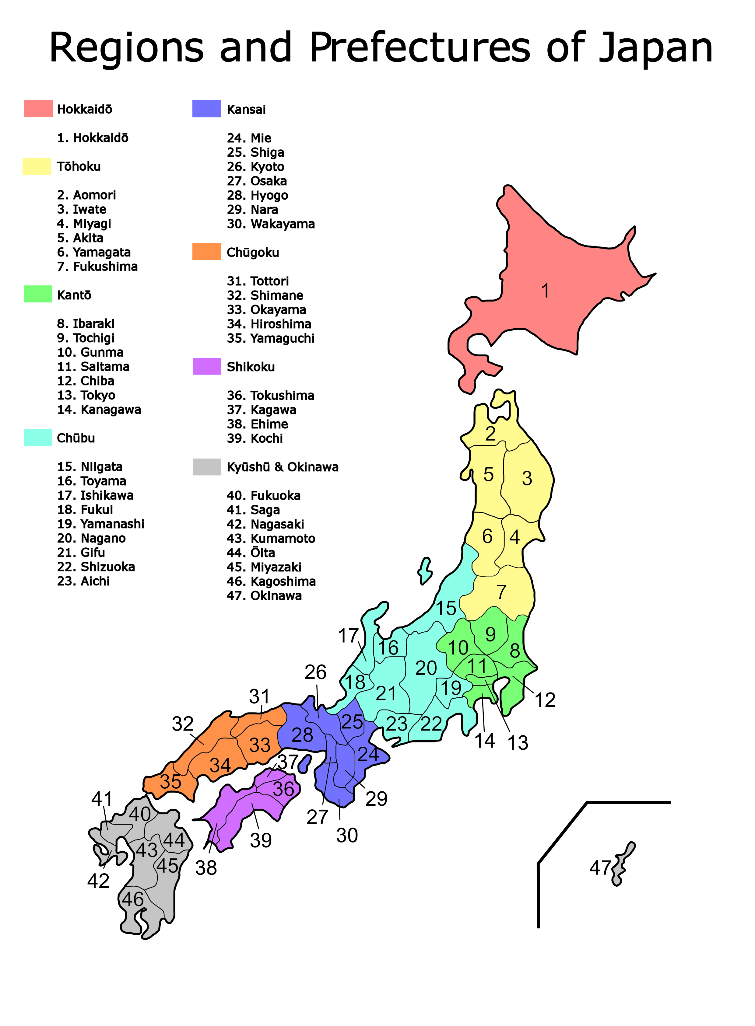
| Description | Map of the regions and prefectures of Japan in ISO 3166-2:JP order. |
| Petsa | |
| Pikuanan | Created from Image:Region system8.png |
| Maki-akda | Bobo12345 |
| Other versions |
Derivative works of this file: |
Pamamie lisensia
| I, the copyright holder of this work, release this work into the public domain. This applies worldwide. In some countries this may not be legally possible; if so: I grant anyone the right to use this work for any purpose, without any conditions, unless such conditions are required by law. |
Amlat ning simpan (File history)
Mag-click kang petsa/oras ba meng akit ing itsura ning simpan aniang panaun a ita.
| Petsa/Oras | Thumbnail | Sukad | Talagamit | Komentu/Puna | |
|---|---|---|---|---|---|
| salukuyan | 05:50, 29 Marsu 2007 | | 2,480 × 3,372 (667 KB) | Bobo12345~commonswiki | {{Information |Description=Map of the regions and prefectures of Japan in ISO 3166-2:JP order. |Source=Created from Image:Region system8.png |Date=29th March 2007 |Author=User:Bobo12345 |Permission= |other_versions=[[Im |
↓Suglung kareng simpan (''file links'')
Ing tutuking page links kaniting simpan (file):
Global file usage
The following other wikis use this file:
- Usage on azb.wikipedia.org
- Usage on bat-smg.wikipedia.org
- Usage on bg.wikipedia.org
- Usage on en.wikipedia.org
- Usage on fr.wikibooks.org
- Usage on hu.wikipedia.org
- Usage on incubator.wikimedia.org
- Usage on lt.wikipedia.org
- Usage on ro.wikipedia.org
- Usage on sa.wikipedia.org
- Usage on sq.wikipedia.org
- Usage on su.wikipedia.org
- Usage on te.wikipedia.org
- Usage on www.wikidata.org
- Usage on zh-min-nan.wikipedia.org