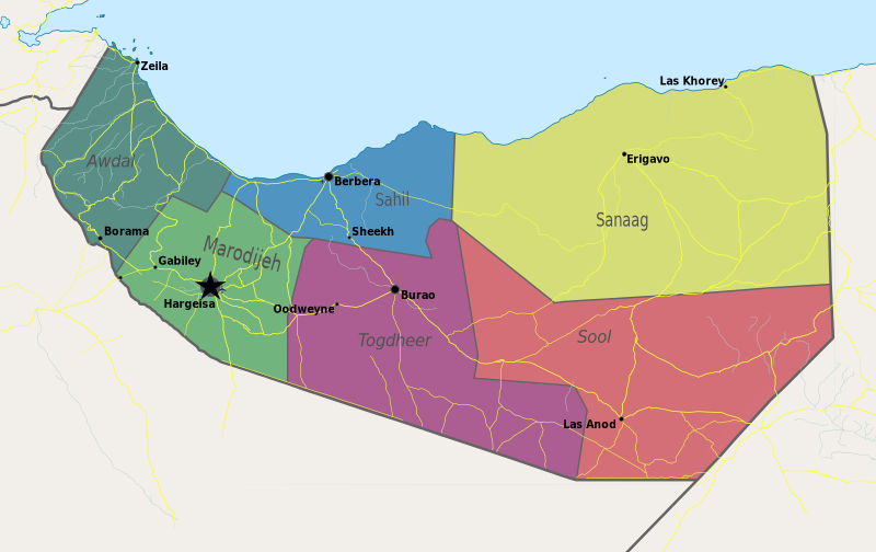
File:Somaliland map.png
Somaliland_map.png (800 × 504 pixel, sukad ning simpan: 99 KB, MIME type: image/png)
Amlat ning simpan (File history)
Mag-click kang petsa/oras ba meng akit ing itsura ning simpan aniang panaun a ita.
| Petsa/Oras | Thumbnail | Sukad | Talagamit | Komentu/Puna | |
|---|---|---|---|---|---|
| salukuyan | 11:55, 10 Mayu 2021 |  | 800 × 504 (99 KB) | Siirski | Update |
| 18:04, 20 Juniu 2020 |  | 1,254 × 741 (42 KB) | Chipmunkdavis | Reverted to version as of 14:41, 2 July 2012 (UTC) Rv unlablled change. The only labelled place is controlled by Somaliland. | |
| 20:31, 17 Juniu 2020 |  | 800 × 473 (64 KB) | Meelpringthusss | clearer color | |
| 02:12, 16 Juniu 2020 |  | 800 × 473 (64 KB) | Meelpringthusss | added disputed areas | |
| 14:41, 2 Juliu 2012 |  | 1,254 × 741 (42 KB) | PANONIAN | {{Information |Description=Map of Somaliland. |Source={{own}} |Date=2012 |Author= PANONIAN |Permission= |other_versions= }} |
↓Suglung kareng simpan (''file links'')
Ing tutuking page links kaniting simpan (file):
Global file usage
The following other wikis use this file:
- Usage on arz.wikipedia.org
- Usage on be.wikipedia.org
- Usage on bn.wikipedia.org
- Usage on bs.wikipedia.org
- Usage on ca.wikipedia.org
- Usage on crh.wikipedia.org
- Usage on dv.wikipedia.org
- Usage on ga.wikipedia.org
- Usage on hr.wikipedia.org
- Usage on hy.wikipedia.org
- Usage on incubator.wikimedia.org
- Usage on ms.wikipedia.org
- Usage on oc.wikipedia.org
- Usage on pnb.wikipedia.org
- Usage on sa.wikipedia.org
- Usage on sco.wikipedia.org
- Usage on sh.wikipedia.org
- Usage on sk.wikipedia.org
- Usage on so.wikipedia.org
- Usage on sr.wikipedia.org
- Usage on su.wikipedia.org
- Usage on ta.wikipedia.org
- Usage on tl.wikipedia.org
- Usage on tr.wikipedia.org
- Usage on ur.wikipedia.org
- Usage on xmf.wikipedia.org

