
File:Uttarakhand locator map.svg

Size of this PNG preview of this SVG file: 666 × 599 pixels. Other resolutions: 267 × 240 pixels | 533 × 480 pixels | 853 × 768 pixels | 1,138 × 1,024 pixels | 2,276 × 2,048 pixels | 1,250 × 1,125 pixels.
Ing minunang simpan (file) (SVG file, masasabing 1,250 × 1,125 pixels, dagul ning simpan: 137 KB)
Sampulung (summary)
| Description |
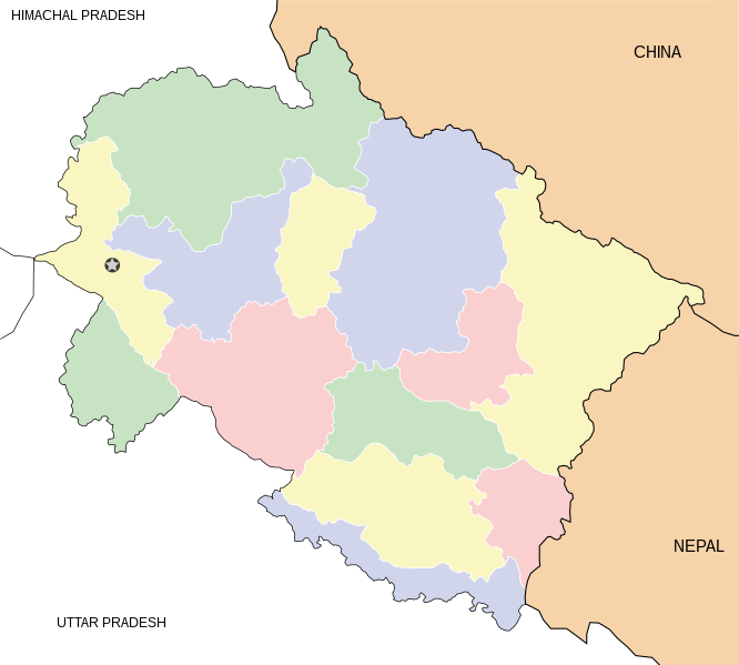
English: Locator map for the state of w:Uttarakhand. Equirectangular projection. Geographic limits of the map: top=31.61, bottom=28.50, left=77.46, right=81.19. |
| Petsa | |
| Pikuanan | Own work |
| Maki-akda | Mkeranat |
Pamamie lisensia
I, the copyright holder of this work, hereby publish it under the following licenses:

|
Permission is granted to copy, distribute and/or modify this document under the terms of the GNU Free Documentation License, Version 1.2 or any later version published by the Free Software Foundation; with no Invariant Sections, no Front-Cover Texts, and no Back-Cover Texts. A copy of the license is included in the section entitled GNU Free Documentation License. |
This file is licensed under the Creative Commons Attribution 3.0 Unported license.
- You are free:
- to share – to copy, distribute and transmit the work
- to remix – to adapt the work
- Under the following conditions:
- attribution – You must give appropriate credit, provide a link to the license, and indicate if changes were made. You may do so in any reasonable manner, but not in any way that suggests the licensor endorses you or your use.
You may select the license of your choice.
Amlat ning simpan (File history)
Mag-click kang petsa/oras ba meng akit ing itsura ning simpan aniang panaun a ita.
| Petsa/Oras | Thumbnail | Sukad | Talagamit | Komentu/Puna | |
|---|---|---|---|---|---|
| salukuyan | 19:48, 1 Marsu 2008 | | 1,250 × 1,125 (137 KB) | Mkeranat~commonswiki | {{Information |Description=Locator map for the state of Uttarakhand updated with white borders for districts |Source=self-made |Date=Feb 2008 |Author= Mkeranat |Permission= |other_versions= }} |
| 13:04, 10 Pebreru 2008 |  | 1,250 × 1,125 (136 KB) | Mkeranat~commonswiki | {{Information |Title=Uttarakhand locator map |Description=Locator map for the state of [w:Uttarakhand]] |Source=self-made |Date=February 2007 |Author= Mkeranat |Permission= |other_versions= }} |
↓Suglung kareng simpan (''file links'')
Ing tutuking 12 pages link kaniting simpan (file):
Global file usage
The following other wikis use this file:
- Usage on ar.wikipedia.org
- Usage on ast.wikipedia.org
- Usage on as.wikipedia.org
- Usage on awa.wikipedia.org
- Usage on ba.wikipedia.org
- Usage on bh.wikipedia.org
- Usage on bn.wikipedia.org
- Usage on ceb.wikipedia.org
- Usage on de.wikipedia.org
- Usage on en.wikipedia.org
- Usage on es.wikipedia.org
- Usage on fa.wikipedia.org
- Usage on gu.wikipedia.org
- Usage on hi.wikipedia.org
View more global usage of this file.