Cuges-les-Pins
Appearance
| {{{official_name}}} |
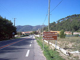
Cuges-les-Pins Entrance of the village of Cuges-les-Pins | ||
| Karinan | ||
| ||
| Ding Koordinayt | ||
| Zona Oras | CET (GMT +1) | |
| Administrasyun | ||
|---|---|---|
| Bangsa | France | |
| Labuad | Provence-Alpes-Côte d'Azur | |
| Departamentu | Bouches-du-Rhône (13) | |
| Arrondissement | Marseille | |
| Canton | Aubagne-Est | |
| Intercommunality | Agglomeration community of Pays d'Aubagne et de l'Etoile | |
| Mayor | Gilles Aicardi (PC) (since 1995) | |
| Statistics | ||
| Altitude | 165 m–1 041 m (avg. 191 m) | |
| Lapad ning gabun¹ | 38.81 km² | |
| Populasyun² | ||
| - 1999 | 3,754 | |
| - Pangasiksik | 96/km² (1999) | |
| Aliwapa | ||
| INSEE/Postal code | 13042/ 13420 | |
| Pamanaus kodiko | 0491 | |
| ¹ French Land Register data, nung nu ela kayabe reng danao, pitak, pinak at glaciers > 1 km² (0.386 sq. mi. o 247 acres) at ilug estuaryo. | ||
| ² Population sans doubles comptes: single count of residents of multiple communes (e.g. students and military personnel). | ||
Cuges-les-Pins metung yang balen at commune ning Bouches-du-Rhône departamentu king mauling France.
Lawen ya rin
[mag-edit | alilan ya ing pikuwanan]Ding Commune ning Bouches-du-Rhône a departamentu
Suglung Palual
[mag-edit | alilan ya ing pikuwanan]- (Frances) Official town website

