
File:5 Boroughs Labels New York City Map Julius Schorzman.png
Size of this preview: 616 × 600 pixels. Other resolutions: 247 × 240 pixels | 493 × 480 pixels | 789 × 768 pixels | 1,052 × 1,024 pixels | 2,104 × 2,048 pixels | 2,652 × 2,582 pixels.
Ing minunang simpan (file) (2,652 × 2,582 pixel, sukad ning simpan: 6.5 MB, MIME type: image/png)
Sampulung (summary)
| Description |
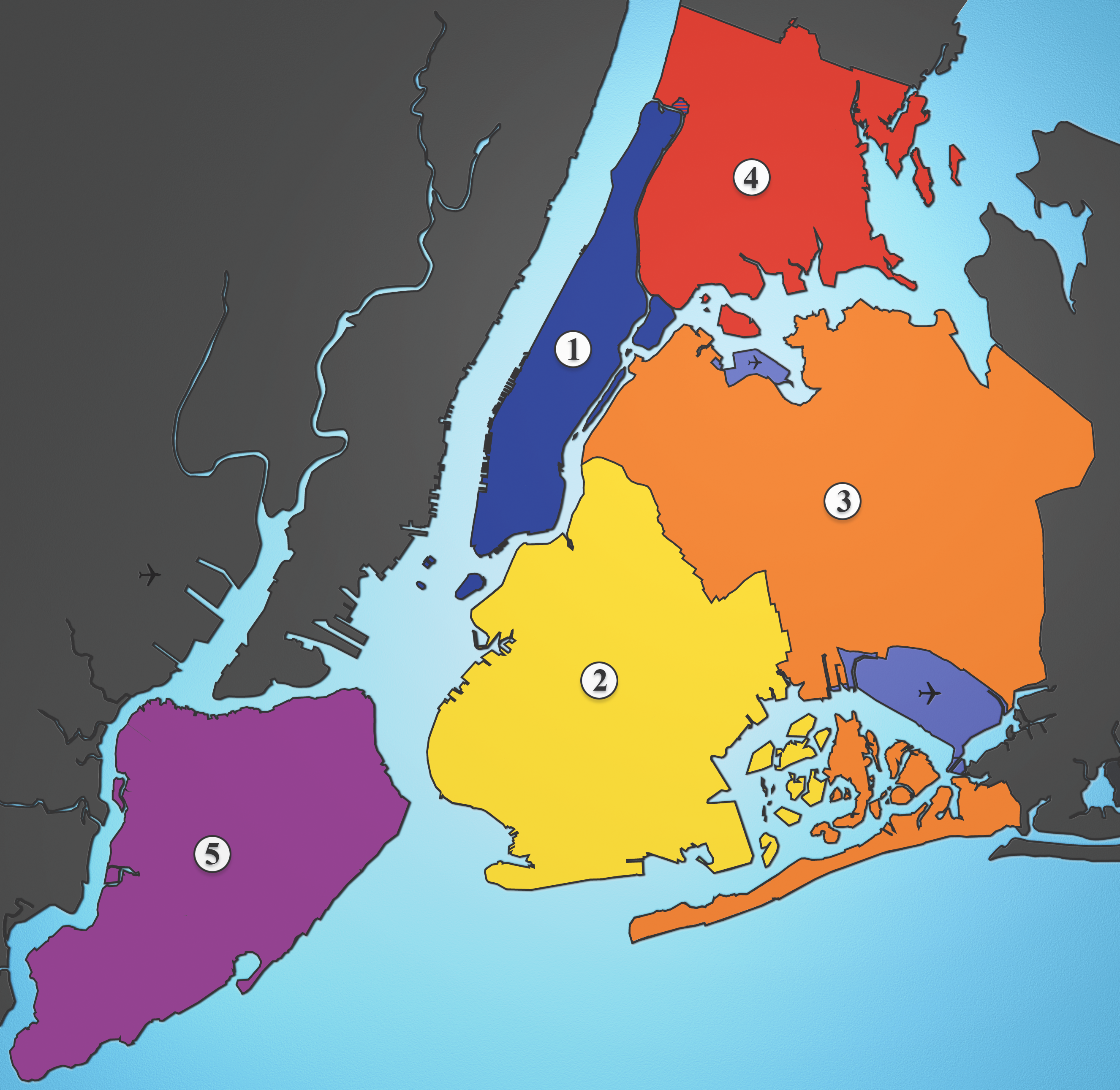
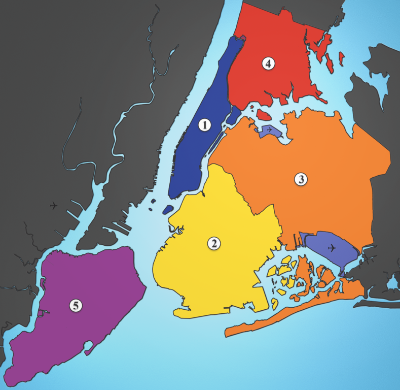
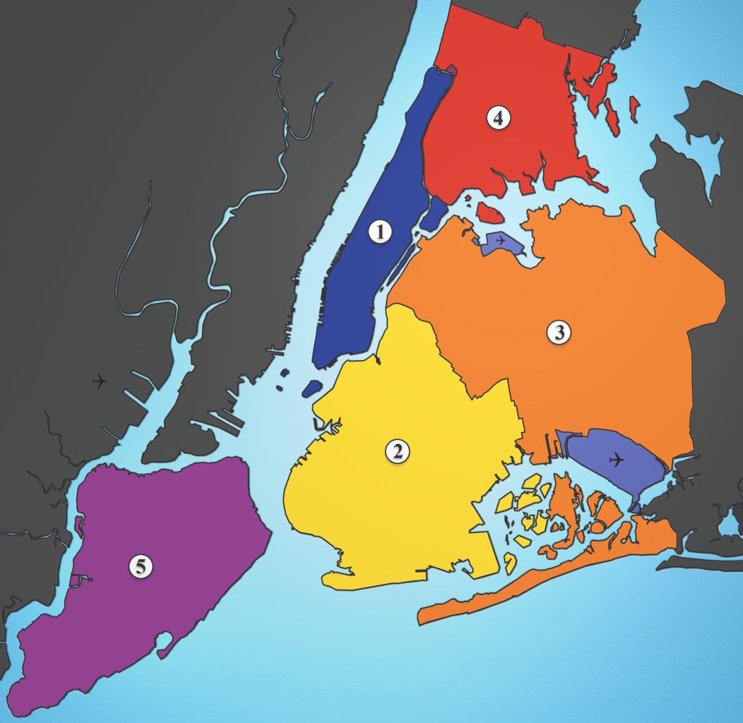
A map showing the five boroughs of New York City, as well as airports. Airports: North East: LGA; South East: JFK; West: EWR |
| Petsa | |
| Pikuanan | I created this image using various maps and images. |
| Maki-akda | Julius Schorzman |
| Other versions |
 |
Pamamie lisensia
This file is licensed under the Creative Commons Attribution-Share Alike 2.5 Generic license.
- You are free:
- to share – to copy, distribute and transmit the work
- to remix – to adapt the work
- Under the following conditions:
- attribution – You must give appropriate credit, provide a link to the license, and indicate if changes were made. You may do so in any reasonable manner, but not in any way that suggests the licensor endorses you or your use.
- share alike – If you remix, transform, or build upon the material, you must distribute your contributions under the same or compatible license as the original.
Amlat ning simpan (File history)
Mag-click kang petsa/oras ba meng akit ing itsura ning simpan aniang panaun a ita.
| Petsa/Oras | Thumbnail | Sukad | Talagamit | Komentu/Puna | |
|---|---|---|---|---|---|
| salukuyan | 02:21, 19 Agostu 2005 | | 2,652 × 2,582 (6.5 MB) | Quasipalm | A map showing the five boroughs of New York City, as well as airports. # Manhattan # Brooklyn # Queens # Bronx # Staten Island Airports: Nort East: LGA Sout East: JFK West: EWR Source: I created this image using various maps and images. {{cc-by-sa-2.5} |
↓Suglung kareng simpan (''file links'')
Ing tutuking page links kaniting simpan (file):
Global file usage
The following other wikis use this file:
- Usage on af.wikipedia.org
- Usage on als.wikipedia.org
- Usage on ar.wikipedia.org
- Usage on ast.wikipedia.org
- Usage on ay.wikipedia.org
- Usage on be-tarask.wikipedia.org
- Usage on be.wikipedia.org
- Usage on bg.wikipedia.org
- Usage on br.wikipedia.org
- Usage on ca.wikipedia.org
- Usage on ca.wikinews.org
- Usage on da.wikipedia.org
- Usage on de.wikipedia.org
- Usage on de.wikivoyage.org
- Usage on diq.wikipedia.org
- Usage on el.wikipedia.org
- Usage on en.wikipedia.org
- Usage on en.wikiversity.org
- Usage on eo.wikipedia.org
- Usage on es.wikipedia.org
- Usage on et.wikipedia.org
- Usage on eu.wikipedia.org
- Usage on ext.wikipedia.org
- Usage on fa.wikipedia.org
- Usage on fi.wikipedia.org
View more global usage of this file.