
File:Solomon Islands adm location map.svg

Ing minunang simpan (file) (SVG file, masasabing 1,890 × 1,097 pixels, dagul ning simpan: 148 KB)
Sampulung (summary)
| Description |
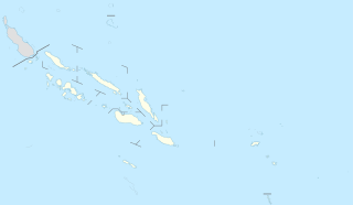
Deutsch: Positionskarte der Salomonen
English: Location map of the Solomon Islands
|
||||||||||||
| Petsa | |||||||||||||
| Pikuanan |
Own work using:
|
||||||||||||
| Maki-akda | NordNordWest | ||||||||||||

|
This map has been made or improved in the German Kartenwerkstatt (Map Lab). You can propose maps to improve as well.
|
Pamamie lisensia
Usage of this file with:

explanatory notes: Legally binding is only the full legalcode. For a free usage I recommend to respect the following licence conditions:
1. Provide my name as given above: NordNordWest,
2. a copy of, or the URI for, the applicable license: https://creativecommons.org/licenses/by-sa/3.0/de/legalcode,
3. the title of the work,
4. in the case of an adaptation, a credit identifying the use of the work in the adaptation.
This license and the rights granted hereunder will terminate automatically upon any breach by you of the terms of this license. Any of the above conditions can be waived if you get permission from the copyright holder. If you have questions or wish differing conditions, please contact me through nnwest or my discussion page ![]() t-online.de
t-online.de
- You are free:
- to share – to copy, distribute and transmit the work
- to remix – to adapt the work
- Under the following conditions:
- attribution – You must give appropriate credit, provide a link to the license, and indicate if changes were made. You may do so in any reasonable manner, but not in any way that suggests the licensor endorses you or your use.
- share alike – If you remix, transform, or build upon the material, you must distribute your contributions under the same or compatible license as the original.

Amlat ning simpan (File history)
Mag-click kang petsa/oras ba meng akit ing itsura ning simpan aniang panaun a ita.
| Petsa/Oras | Thumbnail | Sukad | Talagamit | Komentu/Puna | |
|---|---|---|---|---|---|
| salukuyan | 16:54, 20 Nobyembri 2020 | | 1,890 × 1,097 (148 KB) | NordNordWest | corr |
| 18:36, 15 Marsu 2017 |  | 1,890 × 1,097 (147 KB) | NordNordWest | == {{int:filedesc}} == {{Information |Description= {{de|1=Positionskarte der Salomonen}} {{en|1=Location map of the Solomon Islands}} {{Location map series N |stretching=101 |top=-4.3 |bottom=-13.5 |left=154.4 |right=170.4 }} |Source={{Own using}} * Un... |
↓Suglung kareng simpan (''file links'')
Alang bulung a pakasuglung king simpan (file) a ini.
Global file usage
The following other wikis use this file:
- Usage on ast.wikipedia.org
- Ḥoniara
- Módulu:Mapa de llocalización/datos/Islles Salomón
- Módulu:Mapa de llocalización/datos/Islles Salomón/usu
- Makira
- Kirakira
- Islles Florida
- Islles Nueva Xeorxa
- Vangunu
- Islla de Rennell
- Kolombangara
- Golfu de Kula
- Llaguna de Marovo
- Ranongga
- Nggatokae
- Simbo
- Islles Arnarvon
- Islla Bellona
- Islla de Ghizo
- Islles Duff
- Islla Malaita
- Islla de Savo
- Gavutu
- Islla Kennedy
- Islles Reef
- Islla Choiseul
- Vella Lavella
- Islla Nueva Xeorxa
- Tinakula
- Islla Furona
- Islla de Santa Isabel
- Malaita Sur
- Islla Nendö
- Taumako
- Rennell Este
- Islles Santa Cruz
- Tulagi
- Islla Fera
- Fatutaka
- Anuta
- Tikopia
- Pavuvu
- Utupua
- Usage on bn.wikipedia.org
- Usage on de.wikipedia.org
View more global usage of this file.