Essen

Ibat king Wikipedia

Coordinates: 51°27′3″N 7°0′47″E / 51.45083, 7.01306

Essen
View over the centre of Essen from the "Tetraeder" landmark in Bottrop. In the background the Ruhr Heights.
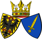
Coat of arms of Essen
Lua error in Module:Location_map at line 501: Unable to find the specified location map definition: "Module:Location map/data/Germany" does not exist.
Administrasiun
Bangsa Aleman
State North Rhine-Westphalia
Admin. region Düsseldorf
Distritu Urban district
City subdivisions 9 districts, 50 boroughs
Lord Mayor Reinhard Paß (SPD)
Governing parties SPDCDU
Basic statistics
Lualas
Katas 116 m  (381 ft)
Populasiun  578,990  (30 Setyembri 2007)[1]
 - Populasiun Pangasiksik 2,753 /km2 (7,130 /sq mi)
 - Urban 5.302.179
Other information
Oras zona CET/CEST (UTC+1/+2)
Licence plate E
Postal codes 45001-45359
Area codes 0201, 02054 (Kettwig)
Website www.essen.de

Coordinates: 51°27′3″N 7°0′47″E / 51.45083, 7.01306

Ing Essen (Pangayagkas a Aleman: [ˈɛsən])metung yang lakanbalen king kalibudtaran dake ning Ruhr Karinan king North Rhine-Westphalia, Aleman. Atiu king Ilug Ruhr, ing kayang populasiun a mga 579,000 (agpang inyang Junio 30, 2008) gagawan neng pang7 o pang8 pekamaragul diling lakanbalen king Aleman.

Despite its industrial history, Essen is generally regarded as one of Germany's greenest cities. The picture shows the borough of Kettwig, annexed in 1975.
Climatic Diagram of Essen[2]
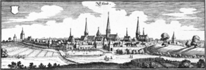
Essen on an engraving from 1647
The west work of Essen Cathedral
The three rings of Krupp
Old and new government seats: Essen Cathedral (front) and the city hall (background)
Essen, ing kayang sagkal armas
Ing Handelshof Hotel kambe ning meyaliling sagkal armas ampong unofficial motto
The RWE Tower
Ing Ruhrschnellweg makayarap papaunta keng kalibudtaran ning Essen
Ing Essen Hauptbahnhof keng kalibudtran lakanbalen
Shaft XII ning Zollverein Uling a Mina


Ing Malagintung Madonna ning Essen
Villa Hügel
Maamlat a kalibudtran balen ning Kettwig
Saalbau

Dalerayan[mag-edit | alilan ya ing pikuwanan]

  • Most sections of this article are translations from the German Wikipedia. The versions used can be found under the following three links: [2], [3] and [4]. The original authors of the German language version can be found here

Footnotes[mag-edit | alilan ya ing pikuwanan]

  1. [1]
  2. Geoklima 2.1

Suglung Palual[mag-edit | alilan ya ing pikuwanan]

Ing Wikimedia Commons atin yang mediang maki kaugnayan kang/king:


Articles Related to Essen
 Geographic locale

Lat. and Long. 51°27′3″N 7°0′47″E / 51.45083, 7.01306

Template:Essen boroughs Template:European Capital of Culture Template:Germany districts north rhine-westphalia Template:World's most populated urban areas