Kotdwara
Appearance
| ?Kotdwara Uttarakhand • India | |
| Coordinates: | |
| Oras zona | IST (UTC+5:30) |
| Lualas • Kátas |
• 454 m (1,490 ft) |
| Distritu | Pauri Garhwal |
| Populasiun | 25,400 (2001) |
| Kodiku • Pincode • Telepanu |
• 246149 • +91-1382 |

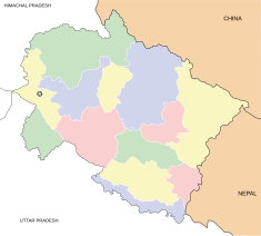
Ing Kotdwara (कोटद्वार) (a ausan da muring Kotdwar) metung yang balen king Pauri Garhwal (distritu) king estadu ning Uttarakhand, India.


