Paktura da reng Counties king California
Salansan da reng California counties
[mag-edit | alilan ya ing pikuwanan]Ding kasalungsungan a bilang da reng counties merapat king kaba ning panaun kapamilatan ding pangarake da ring mangaragul a counties a meging malati. Deng sulgung keng makapababang hilera FIPS County Code ilapin deng keng Census Bureau Info a bulung para ketang countyng ita.
| County | FIPS Code | County Tungku | Melalang | Mitatag ibat | Penibatan ning lagyu | Populasyun | Lapad/Dagul | Mapa |
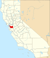
| Alameda County | 001 | Oakland | 1853 | Dake ning Contra Costa County ampong Santa Clara County. | Spanish word meaning a "cottonwood grove". | 1,443,741 | 738 mi² (1,911 km²) |
|
|---|---|---|---|---|---|---|---|---|
| Alpine County | 003 | Markleeville | 1864 | Dake ning Amador County, El Dorado County, Calaveras County, Mono County ampong Tuolumne County. | English word meaning "of, pertaining to, or connected with, the Alps". | 1,208 | 739 sq mi (1,914 km²) |

|
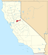
| Amador County | 005 | Jackson | 1854 | Dake ning Calaveras County. | Jose Maria Amador (1794-1883), a soldier, rancher ampong miner. In Spanish, the word amador means "lover of inanimate objects". | 35,100 | 593 sq mi (1,536 km²) |
|
| Butte County | 007 | Oroville | 1850 | Metung kareng aduang pulu't pitung original counties. | From the Sutter Buttes, which lay within the county's borders at the time of its creation. | 203,171 | 1,640 sq mi (4,248 km²) |

|
| Calaveras County | 009 | San Andreas | 1850 | Metung kareng aduang pulu't pitung original counties. | From the Calaveras River | 40,554 | 1,020 sq mi (2,642 km²) |

|
| Colusa County | 011 | Colusa | 1850 | Metung kareng aduang pulu't pitung original counties. | From two Mexican lampong grants; Coluses (1844) ampong Colus (1845). | 18,804 | 1,151 sq mi (2,981 km²) |

|
| Contra Costa County | 013 | Martinez | 1850 | Metung kareng aduang pulu't pitung original counties. | Spanish for opposite coast, because Contra Costa County is across San Francisco Bay from San Francisco | 948,816 | 720 sq mi (1,865 km²) |

|
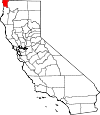
| Del Norte County | 015 | Crescent Lakanbalen | 1857 | Dake ning Klamath County. | Spanish for Northern, because Del Norte County is the northwesternmost county in the state. | 27,507 | 1,008 sq mi (2,611 km²) |
|
| El Dorado County | 017 | Placerville | 1850 | Metung kareng aduang pulu't pitung original counties. | From the mythical El Dorado, The Gilded One, in relation to El Dorado County's importance in the California Gold Rush | 156,299 | 1,712 sq mi (4,434 km²) |

|
| Fresno County | 019 | Fresno | 1856 | Dake ning Mariposa County, Merced County ampong Tulare County. | From Fresno Creek. In Spanish, Fresno means "ash tree". | 799,407 | 5,963 sq mi (15,444 km²) |

|
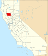
| Glenn County | 021 | Willows | 1891 | Dake ning Colusa County. | Named for Dr. Hugh J. Glenn (1824-1883), a California businessman ampong politician | 26,453 | 1,315 sq mi (3,406 km²) |
|
| Humboldt County | 023 | Eureka | 1853 | Dake ning Trinity County. | From Humboldt Bay, named for Baron Alexamponger von Humboldt (1769-1859), a Prussian naturalist ampong explorer | 126,518 | 3,573 sq mi (9,254 km²) |

|
| Imperial County | 025 | El Centro | 1907 | Dake ning San Diego County.[1] | From the Imperial Valley, which tooks its name from the Imperial Lampong Company | 142,361 | 4,175 sq mi (10,813 km²) |

|
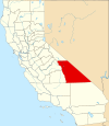
| Inyo County | 027 | Independence | 1866 | Dake ning Mono County ampong Tulare County. | From a Native American word for dwelling place of the great spirit | 17,945 | 10,192 sq mi (26,397 km²) |
|
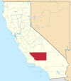
| Kern County | 029 | Bakersfield | 1866 | Dake ning Los Angeles County ampong Tulare County. | From the Kern River, named for Edward Kern, cartographer for General John C. Fremont's 1845 expedition | 661,645 | 8,142 sq mi (21,088 km²) |
|
| Kings County | 031 | Hanford | 1893 | Dake ning Tulare County. | From the Kings River | 129,461 | 1,390 sq mi (3,600 km²) |

|
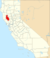
| Lake County | 033 | Lakeport | 1861 | Dake ning Napa County. | From Clear Lake. | 58,309 | 1,258 sq mi (3,258 km²) |
|
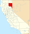
| Lassen County | 035 | Susanville | 1864 | Dake ning Plumas County ampong Shasta County, ampong Dake ning now defunct Lake County, Nevada. | Named for Peter Lassen (1800-1859), a native of Denmark ampong an early explorer of the area. | 33,828 | 4,558 sq mi (11,805 km²) |
|
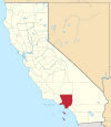
| Los Angeles County | 037 | Los Angeles | 1850 | Metung kareng aduang pulu't pitung original counties. | Spanish for the angels | 9,519,338 | 4,060 sq mi (10,515 km²) |
|
| Madera County | 039 | Madera | 1893 | Dake ning Fresno County. | Spanish for wood | 123,109 | 2,138 sq mi (5,537 km²) |

|
| Marin County | 041 | San Rafael | 1850 | Metung kareng aduang pulu't pitung original counties. | Disputed | 247,289 | 520 sq mi (1,347 km²) |

|
| Mariposa County | 043 | Mariposa | 1850 | Metung kareng aduang pulu't pitung original counties.[2] | Spanish for butterfly | 17,130 | 1,451 sq mi (3,758 km²) |

|
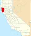
| Mendocino County | 045 | Ukiah | 1850 | Metung kareng aduang pulu't pitung original counties. | From Cape Mendocino, named probably for either Antonio de Mendoza or Lorenzo Suárez de Mendoza, viceroys of New Spain | 86,265 | 3,509 sq mi (9,088 km²) |
|
| Merced County | 047 | Merced | 1855 | Dake ning Mariposa County. | From the Merced River, or in Spanish El Río de Nuestra Señora de la Merced (River of Our Lady of Mercy); named in 1806 by an expedition headed by Gabriel Moraga | 210,554 | 1,929 sq mi (4,996 km²) |

|
| Modoc County | 049 | Alturas | 1874 | Dake ning Siskiyou County. | From the Native American Modoc people | 9,449 | 3,944 sq mi (10,215 km²) |

|
| Mono County | 051 | Bridgeport | 1861 | Dake ning Calaveras County, Fresno County ampong Mariposa County. | - | 12,853 | 3,044 sq mi (7,884 km²) |

|
| Monterey County | 053 | Salinas | 1850 | Metung kareng aduang pulu't pitung original counties. | From Monterey Bay. The name itself is composed of the Spanish words monte (hill) ampong rey (king) | 401,762 | 3,322 sq mi (8,604 km²) |

|
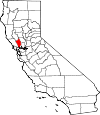
| Napa County | 055 | Napa | 1850 | Metung kareng aduang pulu't pitung original counties. | - | 124,279 | 754 sq mi (1,953 km²) |
|
| Nevada County | 057 | Nevada Lakanbalen | 1851 | Dake ning Yuba County. | - | 92,033 | 958 sq mi (2,481 km²) |

|
| Orange County | 059 | Santa Ana | 1889 | Dake ning Los Angeles County. | From the citrus fruit widely grown in the region at the time the county was formed | 2,846,289 | 790 sq mi (2,046 km²) |

|
| Placer County | 061 | Auburn | 1851 | Dake ning Sutter County ampong Yuba County. | - | 307,004 | 1,503 sq mi (3,893 km²) |

|
| Plumas County | 063 | Quincy | 1854 | Dake ning Butte County. | - | 20,824 | 2,554 sq mi (6,615 km²) |

|
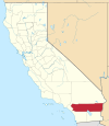
| Riverside County | 065 | Riverside | 1893 | Dake ning San Bernardino County ampong San Diego County. | From the city of Riverside being alongside the Santa Ana River | 1,545,387 | 7,208 sq mi (18,669 km²) |
|
| Sacramento County | 067 | Sacramento | 1850 | Metung kareng aduang pulu't pitung original counties. | From the Sacramento River, itself named for the Santisimo Sacramento (Spanish for Most Holy Sacrament) a reference to the Eucharist | 1,223,499 | 966 sq mi (2,502 km²) |

|
| San Benito County | 069 | Hollister | 1874 | Dake ning Monterey County. | - | 53,234 | 1,389 sq mi (3,597 km²) |

|
| San Bernardino County | 071 | San Bernardino | 1853 | Dake ning Los Angeles County. | Named for Saint Bernardino of Siena | 1,709,434 | 20,062 sq mi (51,960 km²) |

|
| San Diego County | 073 | San Diego | 1850 | Metung kareng aduang pulu't pitung original counties. | Named for San Diego Bay, itself named for Saint Didacus of Alcalá, or San Diego de Alcalá in Spanish | 2,813,833 | 4,204 sq mi (10,888 km²) |

|
| San Francisco County | 075 | San Francisco | 1850 | Metung kareng aduang pulu't pitung original counties. | Francis of Assisi (1181-1226), a Roman Catholic saint ampong founder of the Order of Friars Minor (Franciscans) | 776,733 | 47 sq mi (122 km²) |

|
| San Joaquin County | 077 | Stockton | 1850 | Metung kareng aduang pulu't pitung original counties. | - | 563,598 | 1,399 sq mi (3,623 km²) |

|
| San Luis Obispo County | 079 | San Luis Obispo | 1850 | Metung kareng aduang pulu't pitung original counties. | Spanish for St. Louis, the Bishop. | 246,681 | 3,304 sq mi (8,557 km²) |

|
| San Mateo County | 081 | Redwood Lakanbalen | 1856 | Dake ning San Francisco County. | - | 707,161 | 449 sq mi (1,163 km²) |

|
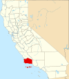
| Santa Barbara County | 083 | Santa Barbara | 1850 | Metung kareng aduang pulu't pitung original counties. | Spanish for Saint Barbara | 399,347 | 2,738 sq mi (7,091 km²) |
|
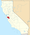
| Santa Clara County | 085 | San Jose | 1850 | Metung kareng aduang pulu't pitung original counties. | - | 1,682,585 | 1,291 sq mi (3,344 km²) |
|
| Santa Cruz County | 087 | Santa Cruz | 1850 | Metung kareng aduang pulu't pitung original counties. | - | 255,602 | 446 sq mi (1,155 km²) |

|
| Shasta County | 089 | Redding | 1850 | Metung kareng aduang pulu't pitung original counties. | - | 163,256 | 3,786 sq mi (9,806 km²) |

|
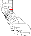
| Sierra County | 091 | Downieville | 1852 | Dake ning Yuba County. | - | 3,555 | 953 sq mi (2,468 km²) |
|
| Siskiyou County | 093 | Yreka | 1852 | Dake ning Shasta County ampong Klamath County. | County named after Siskiyou Mountain Range; etymology of Siskiyou is disputed | 44,301 | 6,287 sq mi (16,283 km²) |

|
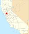
| Solano County | 095 | Fairfield | 1850 | Metung kareng aduang pulu't pitung original counties. | - | 394,542 | 828 sq mi (2,145 km²) |
|
| Sonoma County | 097 | Santa Rosa | 1850 | Metung kareng aduang pulu't pitung original counties. | - | 458,614 | 1,576 sq mi (4,082 km²) |

|
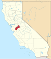
| Stanislaus County | 099 | Modesto | 1854 | Dake ning Tuolumne County. | - | 446,997 | 1,495 sq mi (3,872 km²) |
|
| Sutter County | 101 | Yuba Lakanbalen | 1850 | Metung kareng aduang pulu't pitung original counties. | Named for Johann Augustus Sutter (a.k.a. John Sutter) (1803–1880), a Swiss pioneer of California known for his association with the California Gold Rush | 78,930 | 603 sq mi (1,562 km²) |

|
| Tehama County | 103 | Red Bluff | 1856 | Dake ning Butte County, Colusa County ampong Shasta County. | - | 56,039 | 2,951 sq mi (7,643 km²) |

|
| Trinity County | 105 | Weaverville | 1850 | Metung kareng aduang pulu't pitung original counties. | - | 13,022 | 3,179 sq mi (8,234 km²) |

|
| Tulare County | 107 | Visalia | 1852 | Dake ning Mariposa County. | - | 368,021 | 4,824 sq mi (12,494 km²) |

|
| Tuolumne County | 109 | Sonora | 1850 | Metung kareng aduang pulu't pitung original counties. | - | 54,501 | 2,236 sq mi (5,791 km²) |

|
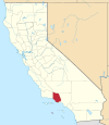
| Ventura County | 111 | Ventura | 1872 | Dake ning Santa Barbara County. | Abbreviation of San Buenaventura, Spanish for St. Bonaventure. | 753,197 | 1,846 sq mi (4,781 km²) |
|
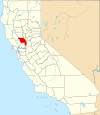
| Yolo County | 113 | Woodland | 1850 | Metung kareng aduang pulu't pitung original counties. | - | 168,660 | 1,012 sq mi (2,621 km²) |
|
| Yuba County | 115 | Marysville | 1850 | Metung kareng aduang pulu't pitung original counties. | - | 71,938 | 630 sq mi (1,632 km²) |

|
Lawen ya rin
[mag-edit | alilan ya ing pikuwanan]
Suglung Palwal
[mag-edit | alilan ya ing pikuwanan]- California State Association of Counties
- State map showing the county names and linking to county data Archived Eneru 4, 2011 at the Wayback Machine
Paktura da reng counties king United States (parishes king Louisiana; boroughs ampong census areas king Alaska) |
|---|
Alabama · Alaska · Arizona · Arkansas · California · Colorado · Connecticut · Delaware · Florida · Georgia · Hawaii · Idaho · Illinois · Indiana · Iowa · Kansas · Kentucky · Louisiana · Maine · Maryland · Massachusetts · Michigan · Minnesota · Mississippi · Missouri · Montana · Nebraska · Nevada · New Hampshire · New Jersey · New Mexico · New York · North Carolina · North Dakota · Ohio · Oklahoma · Oregon · Pennsylvania · Rhode Island · South Carolina · South Dakota · Tennessee · Texas · Utah · Vermont · Virginia · Washington · West Virginia · Wisconsin · Wyoming |
- ↑ The most recent county formed.
- ↑ Mariposa County was the largest of the state's original counties, but territory that was once Dake ning Mariposa is now Dake ning 12 other counties -- Fresno, Inyo, Kern, Kings, Los Angeles, Madera, Merced, Mono, San Benito, San Bernardino, San Luis Obispo, ampong Tulare.

